The following three maps were created using GIS data from the World Wildlife Fund:

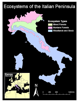
The above map shows a very basic distribution of terrestrial ecosystems of Italy.

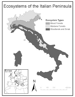
The map above is simply a black and white version of the previous map.
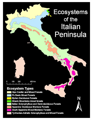
 This last map was created to take a more detailed look at Italy.

The above map shows a very basic distribution of terrestrial ecosystems of Italy.

The map above is simply a black and white version of the previous map.
 This last map was created to take a more detailed look at Italy.
 This map series was particularly fun to create. Among the GIS data files available, I discovered a file belonging to the World Wildlife Fund and decided to explore its various properties. It subdivided the globe into various regions, raging from very broad biomes such as "Tropical" to incredibly specific ecosystems such as "Apennine Deciduous Montane Forests."
My first two maps are essentially identical, except one is designed to fit in with my blog's color scheme while the other is a printer-friendly black and white. Here the ecosystems are very broad in definition, dividing all of Italy into 3 different areas: mixed forest, montane forest, and woodland scrub. The results show that forest are located along mountain ranges (more apparent if mapped with elevation as a second variable) and also more common along higher latitudes.
The last maps takes it a step further and subdivides the three original areas into more descriptive regions described by vegetation type. Again, given a second variable, it would be interesting to see how elevation plays a role in the distribution of the various ecosystems, specially along the Apennines and the Alps. Again, vegetation varies by latitude, so regional differences such as temperature and precipitation would make for interesting variable to create an overlay map.


